The BIG U - New York City

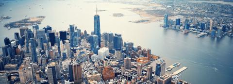
Lower Manhattan, New York City is home to approximately 220,000 people. This area contains some of the largest central business districts in the country, which are at the core of an economy with an annual GDP of approximately $500 billion, influencing economic activity throughout the world. More than 52 million visitors annually come to Lower Manhattan to see sites as the 9/11 memorial, Wall Street, Battery Park and take ferries to the Statue of Liberty and Ellis Island. The Lower Manhattan area also contains 35,000 affordable housing units, many of which were hit hard by Hurricane Sandy, and over 94,000 of the residents in this area are low-income, elderly, and/or disabled. The most vulnerable of the population live along the East River.
Following the devastating impacts of Hurricane Sandy in 2012, the city was challenged to create protection for Lower Manhattan to ensure that New York City’s financial district and other key infrastructure can operate during and after a storm while maintaining and enhancing, local residents’ connection to the waterfront. Flood protection would be designed to enhance everyday life and address existing social, economic and health challenges.
Priority Areas for Intervention
The priority areas of proposed intervention, named “The BIG U” for the shape of the protection around the exterior of Lower Manhattan, is addressed in three compartments that reflect different typologies: ‘East River Park’, ‘Montgomery Street’, and ‘Berms in the Battery’.
At East River Park, an undulating berm along the path of an existing service road inside the park would provide a new flood protection measure. Contoured to avoid interfering with existing sports fields, the berm provides topographic relief and new vistas for the back of the park. The new landscape also increases the resilience of the park with more diverse, salt-tolerant trees and plantings. Generous landscaped bridges will connect East River Park to the community, replacing the now narrow, chain linked passageways. A series of ramps allow residents and visitors a way to move between the park and the bridges. Plazas connect the park with a new scenic bikeway and enhance access to the East River, where a series of new waterfront activities are arrayed along the edge. The flood protection continues to Montgomery Street by fortifying the new Pier 42 Park, where a deployable barrier helps protect the on-ramp to the FDR Drive.
“There’s no question: Superstorm Sandy made clear just how vulnerable we are when it comes to climate change. The risks are real-and growing-and it’s vital that we continue to innovate toward a stronger and more resilient New York.”
- New York City Mayor Bill de Blasio
In the area of Montgomery Street, the team proposed the use of deployable barriers on the underside of FDR Drive. These flood protection devices, which would double as a public art project, are designed to provide lighting and security in these now-dark spaces. Opposite the Public Housing complex Smith Houses, flood protection would come in the form of benches, skate parks, tai chi platforms and a swimming pool, which would be enclosed in glass from four feet up. These features will enliven the waterfront and provide amenities such as laundromats, shops, and spaces for community functions. One of the ground floors is fortified, housing a cogeneration plant for the entire Smith Houses campus. Limited-height flood barriers shield the area against most recurrent floods while allowing waterfront views.
‘Berms in the Battery’, strategically located to protect ducts to critical infrastructure, create a continuous protective upland landscape. In place of the existing Coast Guard building at the tip of Battery Park, the plan envisions a new maritime museum and environmental education facility. This signature building could feature a “reverse aquarium,” with its form derived from the flood protection at the water-facing ground floor, as well as a new Harbor Middle School that will educate students and visitors on our rising sea level. Continuing east, a flood wall connects through the Staten Island Ferry building and aligns with the FDR Drive at the Battery Maritime Building. An elevated plaza brings the latter’s monumental mezzanine floor level with its surroundings. The plaza connects to an elevated bikeway, which, in turn, connects to a series of pavilions providing flood protection in conjunction with sliding flood gates. A sequence of attractive urban spaces on the waterfront protect the city while serving and delighting the millions of visitors and thousands of workers in the area.
Future Plans and Investments
As a winner of the Rebuild by Design competition, the East River Park compartment of the proposal was awarded $335 million dollars by the federal government. The program’s planning is currently underway. This compartment, named the East Side Coastal Resiliency Project will also receive an additional $100 million from the City of New York. Future targets of investment include funding additional compartments of the proposal via National Disaster Resilience Competition funding. To learn more about the status of the project visit www.rebuildbydesign.org.
