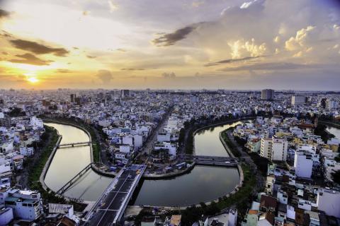
Ho Chi Minh City, Vietnam

Ho Chi Minh City, Vietnam. © Dung Pham Hoang Tuan/Shutterstock
Ho Chi Minh City (HCMC) is located in the delta area of the Saigon and Dong Nai rivers. It is Vietnam’s largest city and an important economic, trade, cultural and research centre, both within the country, and in South- East Asia. HCMC has a diversified topography, ranging from mainly agricultural and rural areas in the north to a widespread system of rivers, canals and dense mangrove forest to the south. The urban areas are located approximately 50km (31.1 miles) inland from the Pacific Ocean.
Similar to other evolving mega-cities in South-East Asia, Ho Chi Minh City has experienced rapid changes in recent decades. The city’s population has more than doubled from 3.9 million in 1989 to approximately 8 million inhabitants in 2010. The regional economy has continuously grown with double-digit growth rates and HCMC contributes nearly 30 per cent to the national GDP and received 37 per cent of total foreign direct investments in 2009.
Key Challenges
HCMC faces major challenges in terms of infrastructure development, public transport, flood prevention and the provision of other public services due to its ongoing rapid growth. These challenges will be amplified given the projected changes in climate. The main climate challenge is urban flooding due to heavy rainfall and insufficient drainage capacity, exacerbated by fast urban development occurring on low-lying marshland, higher frequency of heavy rainfall events (attributed to the urban heat island effect) and projected or already occurring sea-level rise.
Urban flooding has become a wide-spread phenomenon and a major concern in HCMC in recent years that has been accompanying the city’s rapid growth. Especially since the beginning of the 1990s the amount of flooded locations, flood frequencies and flood duration has steadily increased and has caused substantial economic and social losses, such as damage to infrastructure and assets, water pollution as well as traffic jams.
Priority Areas for Intervention
Vietnam in general, and HCMC in particular, have been identified as one of the most severely affected places by future climate change and especially sea level rise. During recent decades, changes in the regional climate have already been observed. The average annual temperature has increased by 0.6 degrees during the last seven decades. Whilst the annual volume of rainfall has remained fairly stable, the number of heavy rainfall events (>100 mm/3.94 inches of rain) has increased remarkably. The sea level rose by 20cm in the last 50 years with a rate of about 3mm (0.1 inch) per year during the period 1993- 2008. It is projected to rise another 28 to 33cm by 2050, posing a major challenge to low-lying HCMC. Today, approximately 60 per cent of the urban area is located less than 1.5 Meter above sea level, making it highly vulnerable to projected sea-level rise. That is even increasing with the land subsidence of several centimetres per year in some parts of the city.
Priority for Intervention - Resilience Building Efforts
To address these multiple climate-change related impacts, HCMC adopted its comprehensive Climate Adaptation Strategy in April 2013, within the ‘Moving Towards the Sea with Climate Change Adaptation’ project initiated in 2011 with assistance from Rotterdam. Based on the Triple-A Strategic Planning method (Assessment Atlas – Adaptation Strategy – Action Plan), the integrated Strategy consists of six directions: create smart urban density with connected living and working areas; develop step-by-step multi-scale flood protection measures; avoid local rainwater flooding by improving drainage and storage systems; reduce salinisation problems by relocating drinking water intakes upstream; and reduce land subsidence by restricting groundwater abstraction and improving surface water quality; reduce urban heat stress through developing the urban green-blue network.
“Ho Chi Minh City is a major centre of economic, cultural, education and training, science and technology. And the leading economic city of the country and the southern key economic region. Ho Chi Minh City faces many challenges with regard to climate change, which directly threatens social life, damages the economy and degrades the quality of the living environment of the city. The jointly developed Adaptation Strategy is the basis for further developing the city towards a climate-proof future.”
- Professor Mr. Nguyen Huu Tin, Mayor of Ho Chi Minh City, HCMC Vice Chairman
Currently in implementation, the Climate Adaptation Strategy has divided the City into implementation zones, with on-going pilot projects in each. The pilot activities include relocation of harbour infrastructure from the dense city area (District 4) – which opens space for climate adaptation measures including improvements in the urban landscape such as parks to provide stormwater attenuation - towards the sea and onto low-lying areas (Nha Be District). These low-lying areas and the new harbour facilities on them are adapting flood proofing measures as they are located outside of planned dykes. The larger city-wide Strategy is being complemented by other measures, including: a mandate for all new developments to be elevated 2 - 2.5 m above mean sea level; a polder system to be built around the city with around 200 km of dykes and hundreds of tidal gates; and work- shops on community based adaptation (early warning systems in communities and design of evacuation routes and drainage channels); in addition to on-going research by HCMC University on entire city modelling and simulations of probable flooding events.
